


Оценок - 3, средний балл: 4.3
(

 )
)
|
Фото и характеристики Garmin GPSMAP 296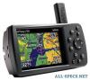 |


Фрагмент инструкции
You need to create a new route with current Jeppesen Database points. Active Route Page Options Press MENU while on the Active Route Page to open the options menu. You can edit the route using many of the options in the menu such as Edit on Map (see page 72 for information), Add Waypoint, and Invert. You can also change the data fields to suit your needs. You can also select an approach for your landing and set your fuel flow (or plan your route, based on your current Usage Mode): Select Approach—(Aviation Only) allows you to select the final course segment of a published approach, replacing the final destination airport in a Go To or route with the sequence of waypoints for the selected approach. The approaches provide only the final course segment, usually from final approach fix (FAF) to missed approach point (MAP), and are based on existing GPS, RNAV, VOR, NDB, localizer, or ILS approach procedures. All approach procedures are flown as a sequence of waypoints in the route. To select an approach and add the waypoints to the route, the final destination in the Go To or route must be an airport with a published approach. Set Fuel Flow (Plan Route)—allows you to enter information about your aircraft and route. GPSMAP 296 Pilot’s Guide AVIATION MODE PAGES > POSITION DATA PAGE Position Data Page The Position Data Page provides a quick reference for the important data you want to show while navigating a route in Aviation and Marine Modes. The default page shows a compass ribbon, your current latitude and longitude, the current date and time, the location you are in reference to the nearest landmark, and eight user- selectable data fields. The compass ribbon is shown at the top of the page to show your current heading with a red, vertical bar. To stay on course, steer toward the violet bar (or arrows) until it is aligned with the red bar. Press PAGE repeatedly to open the Position Data Page. Position Data Page Airport is selected as the Nearest Type. The Johnson Co Executive (KOJC) airport is the nearest airport, and you are 4.0 nm NW of KOJC. Position Data Page Options With the Position Data Page open, press MENU to open the options menu. You can set up the layout of the page and change the data fields. For an explanation of the data fields, refer to page 148 in the “Appendix.” You can also select one of the following options: Change Nearest Type—allows you to specify the type of item to be used as the nearest item (shown in the lower-left data field). The choices differ based on the Usage Mode you are currently using. Choose Automatic to allow the unit to pick the appropriate type of landmark for your present location. Reset Trip—clears trip information, except the maximum speed and the odometer. Reset Max Speed—clears the maximum speed. Reset Odometer—clears the running total of the distance traveled since the odometer was last reset. Reset All—clears all trip information including the maximum speed and odometer. GPSMAP 296 Pilot’s Guide AVIATION MODE PAGES > FLIGHT LOG Flight Log The Flights tab shows a list of any recorded flights, including date, route of flight, and flight time. The GPSMAP 296 saves up to 50 recorded flights while in Aviation Mode. Entries on this list are automatically created for each flight. The bottom of the Flights tab shows the time of your last flight. This resets if you select All Unit Defaults from the System tab options menu. An optional FlightBook software package is available to further simplify your flight record keeping. For details about FlightBook, visit the Garmin Web site at Viewing the Flight Log Recording begins when your speed exceeds 30 knots and you gain 500 feet of altitude. The Route of Flight field uses the nearest airport as the departure airport. The destination airport is continuously updated as your flight progresses. If you land and groundspeed drops below 30 knots, the flight entry is saved and a new entry is recorded when you depart the airport. A touch-and-go or brief stop of less than 10 minutes appends to the current flight record, rather than starting a new entry. Select any listed entry in the log to view additional information. To view details for a flight: 1. Press MENU twice to open the Main Menu. 2. Highlight Flights from the vertical menu of tabs. 3. Press MENU and select Show Hours and Minutes to view the flights in minutes and hours, if you prefer. 4. Highlight the flight, and press ENTER. The flight details window opens, shown below. 5. With OK highlighted, press ENTER to return to the Flights tab. Flight Tab Showing the flight details page Deleting Flight Records You can delete the highlighted flight record (Delete Flight) or delete all flight records from the Flight Log (Delete All). To delete flights, press MENU (with the Flights tab information shown). Use the ROCKER to highlight a menu option, and press ENTER. GPSMAP 296 Pilot’s Guide AVIATION MODE PAGES > AIRCRAFT INFORMATION Aircraft Information The Airc...